This site requires Cookies enabled in your browser for login.
Updating ...
WaterNet Home
WaterNet
for
pour le
Canada
Menu
WaterNet
Home
GWFO
Home
Master
List
Data
Centre
Collections
X
Defaults
Select All
Websites
X
Global Water Futures Observatories (GWFO) Global Water Futures (GWF) Global Institute for Water Security (GIWS) International Network of Alpine Research Catchment Hydrology
Legacy Research Programs
X
Changing Cold Regions Network (CCRN) Drought Research Initiative (DRI) International Network of Alpine Research Catchment Hydrology (Legacy Site) Improving Processes & Parameterization for Prediction in Cold Regions Hydrology (IP3) The Mackenzie Global Energy and Water Cycle Experiment (GEWEX) Study (MAGS)
Legacy sites
Map
Utilities
X
Account Settings Metadata Editor Record List Alias List Editor
Data Centre
Data Type Editor
. . .
X
Clear
Select All
Advanced Search
Go to Top⇡
Related items loading ...
Fetching Chart ...
Overview Research Site Status and Provenance Access and Downloads
Name of Research Project
Related Project
Part
GWF-MWF: Mountain Water Futures
Core Modelling and Forecasting Team
NGHM
GWF-IMPC: Integrated Modelling Program for Canada
A2
Dataset Title
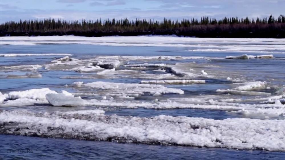
Two Centuries of Kluane Lake Inflows, Levels and Outflows (daily data)
Additional Information
GeoNetwork Record: www.gwfnet.net/geonetwork/srv/eng/catalog.search#/metadata/120cdd55-b2e1-4dac-92fb-71c8b7e8bb96
Abstract
The MESH model was used here to simulate the hydrology of Kluane Lake during three periods: the 20th Century using EU WATCH forcing data, recent time (2000-15) using WRF forcing data bias corrected with GEM-CaPA, through the future using PGW RCP8.5 scenario by the end of the 21st Century. Model outputs include daily lake inflow, outflow, and water level.
Purpose
Kluane Lake (Lhù'ààn Mǟn) Study: This modeling study was motivated and required by Yukon Government following the retreat of the Kaskawulsh Glacier in 2016, causing the Slims River (Ä'äy Chù) Piracy and depriving Kluane Lake from its most important summer inflow and as a consequence left summer lake levels 1.6 metres lower than their normal. The MESH model was used here to simulate the hydrology of Kluane Lake during three periods: the 20th Century using EU WATCH forcing data, recent time (2000-15) using WRF forcing data bias corrected with GEM-CaPA, through the future using PGW RCP8.5 scenario by the end of the 21st Century.
Temporal Extent
Begin Date
End Date
1901-01-01
2099-01-01
Geographic Bounding Box
West Boundary Longitude
-139.9
East Boundary Longitude
-137.8
North Boundary Latitude
61.9
South Boundary Latitude
60.4
Is Boundary Rectangular
◉ Yes
○ No
Research Site Description (if needed)
Lhù'ààn Mǟn - Kluane Lake, Yukon Territory ( http://www4.nrcan.gc.ca/search-place-names/unique/2ce1e9fed05511d892e2080020a0f4c9 )
Basin
09
Subbasin
09CA
Dataset Version
1
Status of data collection/production
○ Planned
○ In Progress
○ Abandoned
◉ Complete
Data Update Frequency
○ Continually
○ Daily
○ Weekly
○ Biweekly
○ Monthly
○ Anually
○ As needed
○ Irregular
◉ None planned
○ Unknown
Primary Source of Data
◻ Unknown/Unspecified
◻ Census
◻ Field collected samples
◻ Field experiment
◻ Field observation
◻ Field survey
◻ Human biological samples
◻ Lab experiment
▣ Model simulation
◻ Previously collected
◻ Qualitative (from observations or interviews)
◻ Social survey
◻ Traditional knowledge
◻ Other Source of Data (Please specify in field below)
Data Lineage (if applicable). Please include versions (e.g., input and forcing data, models, and coupling modules; instrument measurements; surveys; sample collections; etc.)
Model name: MESH Model version number: 1398 modified for ice melt Model source/webpage: Model output pre-processing script: Model output post-processing script: Model setup Time step: 1 hour Initial condition: Boundary condition: Additional information:
Does the data have access restrictions?
▣ No restriction (data is currently open to public)
◻ Limited (data is currently under embargo until publication)
◻ Limited (data involves intellectual property issues related to local or traditional knowledge)
◻ Limited (release of data may cause harm to the environment or to the public)
◻ Limited (pre-existing data has been used and is subject to access restrictions)
◻ Limited (data involves human subjects)
◻ Limited (data is supported by industry partnerships)
◻ Limited (data is supported by government partnerships)
Download Links and Instructions
Data can be accessed by contacting Youssef Loukili (youssef.loukili@usask.ca)
File formats and online databases
◻ Link to online database or web services (e.g., WISKI, ECCC)
◻ Archive files (.zip, .rar, .7z, .tar, .tgz, .tar.gz, etc.)
▣ CSV files (.csv - comma or tab separated value files)
◻ Excel document files (.xlsx, .xls)
◻ Image files (e.g., .tiff, .jpeg, .png, .gif, etc.)
◻ NetCDF files (.netcdf, .nc)
◻ Text files (.txt)
◻ Word document files (.docx, .doc)
◻ Other (Please specify in field below)
© 2026 - WaterNet Version 2026-06-15
Global Water Futures Observatories
Powered by
G W F Net
T-2021-09-13-a1BPq3BfSokqJt1dzmkmGPA Dataset 1.2