
Related items loading ...
Section 1: Site Overview
Research Site Name
Rofental High Alpine Research Basin Research Site #1
Research Site ID #
Catchment Name
Rofental High Alpine Research Basin
Primary Contacts
|
Ulrich Strasser | Primary Contact | |
Site Location
|
Coordinate Format
|
Latitude
|
Longitude
|
|
Degrees Minutes Seconds
|
See catchment
|
|
|
Decimal Degrees
|
|
|
Elevation
|
Minimum
|
Maximum
|
|
See catchment
|
|
Additional Features of this Site
Additional Information (notes, web addresses, etc.)
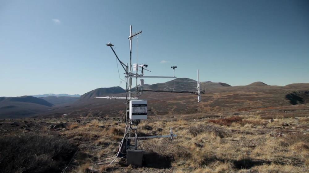
Section 3: Forcing Data
Standard Forcing Variables
|
Forcing Variable
|
Instrumentation Description
|
Temporal Resolution
|
|
T
|
various
|
Every 10 minutes
|
|
RH
|
various
|
Every 10 minutes
|
|
K in
|
Kipp&Zonen
|
Every 10 minutes
|
|
K out
|
Kipp&Zonen
|
Every 10 minutes
|
|
L in
|
Kipp&Zonen
|
Every 10 minutes
|
|
L out
|
Kipp&Zonen
|
Every 10 minutes
|
|
Net Radiometer
|
Kipp&Zonen
|
Every 10 minutes
|
|
Wind Speed
|
Kroneis and other
|
Every 10 minutes
|
|
Wind Direction
|
Kroneis and other
|
Every 10 minutes
|
|
Precipitation
|
Ott Pluvio and other (+ Pritchard lake sensor)
|
Every 10 minutes
|
|
Pressure
|
Yes
|
Every 10 minutes
|
Additional Forcing Variables
Additional Forcing Variable Information
ca. 9 automatic weather/snow stations
Section 4: Hydrological Instrumentation
Standard Hydrological Instrumentation (including sensor name and model)
|
Hydrological Variable
|
Instrumentation Description
|
Temporal Resolution
|
|
Water Level
|
Yes
|
|
|
Discharge Method
|
Yes
|
|
|
Water Temperature
|
Yes (Vent)
|
|
|
Isotope Types (e.g., O18, D, T)
|
Sampler available at the gauge Vent
|
|
|
Water Conductivity
|
Sampler available at the gauge Vent
|
|
|
Turbidity
|
|
|
|
Sediment Load (Gravels)
|
Only suspended load
|
|
|
Water Sampling Hydrogeochemistry (Elements)
|
|
|
|
Groundwater Level
|
|
|
|
Soil Moisture
|
|
|
Additional Hydrological Instrumentation
Additional Hydrological Information
Section 5: Hydrometric/Cryospheric Measurements
Standard Hydrometric/Cryospheric Measurements
|
Hydrometric/Cryospheric Variable
|
Measurement Description
|
Temporal Resolution
|
|
Terrestrial Laser Scanner
|
Yes, for Hintereisferner
|
N/A
|
|
UAV Sensors
|
|
N/A
|
|
Snow Surveys
|
For COPE
|
N/A
|
|
Time-lapse Photographs
|
Yes
|
|
|
SWE Instruments, Pillows
|
1 pillow, 2 scales, 1 Snow Pack Analzer, 1 Hydroinnova SnowFox
|
|
|
Snow Depth
|
Sommer USH-8 / USH-9, Campbell SR50
|
|
|
Soil Temperature
|
Sommer, Campbell 107
|
|
|
Surface Temperature
|
Sommer, Kipp&Zonen CNR4
|
|
|
Eddy Covariance
|
Not permanent, but availbale for campaigns
|
|
|
Ice Elevation
|
Hintereisferner
|
N/A
|
|
Debris Covered Ice Elevation
|
Hintereisferner
|
N/A
|
|
GlacierMassBalance
|
Hintereisferner, Vernagtferner, Kesselwandferner
|
N/A
|
|
Glacier Ice Thickness
|
yes (1997)
|
N/A
|
Additional Hydrometric/Cryospheric Measurements
Additional Hydrometric/Cryospheric Measurement Information
Section 6: Hydrological Modelling Data
Vegetation Map
Corine land cover
Soil Map
European soil database
Soil Depth Information
Digital Elevation Map (and Spatial Resolution)
Yes, super high resolution available
Additional Modelling Information
 Metadata Editor
 Record List
 Alias List Editor
 Legacy sites

 GWFNet
 Master
 Research
 Map
Map
 Advanced
 Tools
Tools
 . . .
. . .